Lochinvar National Park
Lochinvar, although not abundant in the larger mammals, is nonetheless a park of exceptional beauty and outstanding birding opportunities with over 420 recorded species in its 428 square kilometers.
The Park is situated on the southern edge of the Kafue Flats, a wide floodplain of the Kafue River between Itezhi tezhi dam in the west and Kafue Gorge in the east. The area extends for 33kms from the Kafue River in the north to low wooded hills in the south. It includes the large, shallow Chunga Lagoon which fluctuates considerably in size with variations in river levels. The varying vegetation makes it an interesting park to visit with floodplains, woodlands and termitaria
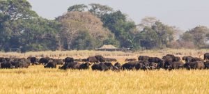
It is particularly well known for the large herds of Kafue lechwe, unique to the Kafue flats. Other antelope are the blue wildebeest, kudu, oribi and buffalo. Waterbirds are especially abundant.
The Kafue Flats floodplain, in the northern section, floods from the Kafue River, and here you’ll find thousands upon thousands of the endemic Kafue lechwe, one of three subspecies of lechwe found in Zambia. More than 30 000 of them make the flats their home and move seasonally according to the flood level.

At high water, massive herds may be seen along the upper floodline and in the open grassland further south. As the floods recede the herds move north into the grassy floodplain. They feed on grasses and herbs in water up to a meter deep and are often seen wading or swimming in the Chunga Lagoon. Mating takes place mainly between December and January. Males fight over small territories known as leks and then mate with several females.
In the Termitaria Zone, trees and shrubs grow only on the large termite mounds with grasses and herbs covering the rest of the area, which often becomes waterlogged during the rainy season. There are also many small grey mounds which are always unvegetated. The magpie shrike is one of the birds to be seen in the scattered trees of this zone and the surrounding grassy plains are grazed by buffalo, zebra, wildebeest and oribi. Very much in evidence is the ‘candelabra’ tree.
The southern area is mainly woodland, dominated by Acacia albida and Combretum trees and is free from flooding. Bushbuck kudu, baboon, bushpig and vervet monkey inhabit this area.
The Gwisho Hot Springs occur along a geological fault here, surrounded by lush vegetation and vegetable ivory palms. The water rises by convection from depths of over 1 km with temperatures ranging from 60° to 90° C. There are high concentrations of sodium, chlorine, calcium and sulphates in the water. A distinctive rock known as a ‘fault breccia’ occurs along the line of the fault and can be seen at Gwisho or the Lodge.
Sebanzi Hill is an archaeological site which has been excavated. It was the site of an iron age village, inhabited for most of the last century. Look out for The Baobab Tree with a hollow trunk large enough for several people to sleep in. Historically the tree was said to boast special powers which would protect passing travellers from wild animals. There is a curious rocky outcrop called Drum Rocks not far from the lodge, which produces a resonant sound when tapped. They are also part of local superstition in former times and passers-by had to stop and greet the rocks before proceeding.


